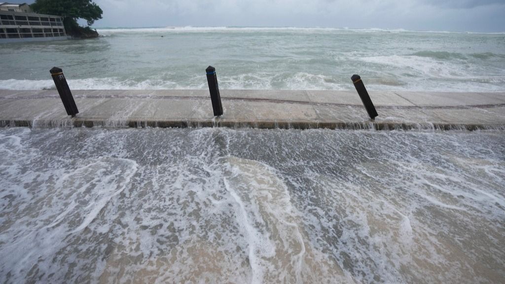
Barbados: Hurricane Beryl’s explosive growth into an unprecedented early whopper of a storm shows the literal hot water the Atlantic and Caribbean are in right now and the kind of season they can expect, experts said.
Beryl smashed various storm records even before its major hurricane level winds approached land. The powerful storm is acting more like monsters that form in the peak of hurricane season thanks mostly to water temperatures as hot or hotter than the region normally gets in September, five hurricane experts told The Associated Press.
Beryl set the record for earliest Category 4 with winds of at least 130 mph (209 kilometers per hour) — the first-ever category 4 in June. It also was the earliest storm to rapidly intensify with wind speeds jumping 63 mph (102 kph) in 24 hours, going from an unnamed depression to a Category 4 in 48 hours.
Beryl is on an unusually southern path, especially for a major hurricane, said University at Albany atmospheric scientist Kristen Corbosiero.
It made landfall Monday on the island of Carriacou with winds of up to 150 mph (240 kph), just shy of a top Category 5 storm, and is expected to plow through the islands of the southeast Caribbean.
“Beryl is unprecedentedly strange,” said Weather Underground co-founder Jeff Masters, a former government hurricane meteorologist who flew into storms. “It is so far outside the climatology that you look at it and you say, ‘How did this happen in June?’”
Get used to it. Forecasters predicted months ago it was going to be a nasty year and now they are comparing it to record busy 1933 and deadly 2005 — the year of Katrina, Rita, Wilma and Dennis.
“This is the type of storm that we expect this year, these outlier things that happen when and where they shouldn’t,” University of Miami tropical weather researcher Brian McNoldy said. “Not only for things to form and intensify and reach higher intensities, but increase the likelihood of rapid intensification. All of that is just coming together right now, and this won’t be the last time.”
Colorado State University hurricane researcher Phil Klotzbach called Beryl “a harbinger potentially of more interesting stuff coming down the pike. Not that Beryl isn’t interesting in and of itself, but even more potential threats and more — and not just a one off — maybe several of these kinds of storms coming down later.”
The water temperature around Beryl is about 2 to 3.6 degrees (1 to 2 degrees Celsius) above normal at 84 degrees (29 Celsius), which “is great if you are a hurricane,” Klotzbach said.
Warm water acts as fuel for the thunderstorms and clouds that form hurricanes. The warmer the water and thus the air at the bottom of the storm, the better the chance it will rise higher in the atmosphere and create deeper thunderstorms, said the University at Albany’s Corbosiero.
Sea surface temperatures in the Atlantic and Caribbean “are above what the average September (peak season) temperature should be looking at the last 30-year average,” Masters said.
It’s not just hot water at the surface that matters. The ocean heat content — which measures deeper water that storms need to keep powering up — is way beyond record levels for this time of year and at what the September peak should be, McNoldy said.
“So when you get all that heat energy you can expect some fireworks,” Masters said.
This year, there’s also a significant difference between water temperature and upper air temperature throughout the tropics.
The greater that difference is, the more likely it becomes that storms will form and get bigger, said MIT hurricane expert Kerry Emanuel. “The Atlantic relative to the rest of the tropics is as warm as I’ve seen,” he said.
Atlantic waters have been unusually hot since March 2023 and record warm since April 2023 . Klotzbach said a high pressure system that normally sets up cooling trade winds collapsed then and hasn’t returned.
Corbosiero said scientists are debating what exactly climate change does to hurricanes, but have come to an agreement that it makes them more prone to rapidly intensifying, as Beryl did, and increase the strongest storms, like Beryl.
Emanuel said the slowdown of Atlantic ocean currents, likely caused by climate change, may also be a factor in the warm water.
A brewing La Nina , which is a slight cooling of the Pacific that changes weather worldwide, also may be a factor. Experts say La Nina tends to depress high altitude crosswinds that decapitate hurricanes.
La Nina also usually means more hurricanes in the Atlantic and fewer in the Pacific. The Eastern Pacific had zero storms in May and June, something that’s only happened twice before, Klotzbach said.
Globally, this may be a below average year for tropical cyclones, except in the Atlantic.
On Sunday night, Beryl went through eyewall replacement, which usually weakens a storm as it forms a new center, Corbosiero said. But now the storm has regained its strength.
“This is sort of our worst scenario,” she said. “We’re starting early, some very severe storms. .. Unfortunately, it seems like it’s playing out the way we anticipated.
How The Hot Water that Fueled Hurricane Beryl Foretells a Scary Storm Season world-news World News | Latest International Global World News | Todays Breaking News Headlines


